You are here
Home -
Kumaon Road Trip -
Munsyari Town Stay - Part 1
Here is some background information on this region:
Tales from the land of the Bhotias (Johar, Darma, Vyans valleys)
The boundaries of this region are as follows – on the west, Kali river, Tinjar village, Palamgunj and Chavangro mountains separate it from Nepal. On the south lies Askot. On the west, Johar valley separates it from Chamoli district (Nanda Devi sanctuary) and on the north; the passes of Nawe Danda and Lipu Danda separate it from Tibet (Hundesh or Country of Huns).
The main peaks are Panchchuli, Paljung, Tara, Lipu, Tinkar, Nirpania and chiplakedar. The main rivers are dhauli, gori, kali, soblagad and galagad.
Vyans area: This area borders Hundesh (Tibet) near the Taklakhal (Taklakot) area. The peaks near the border are called Lipudhura (where Lipish Mahadev stays) and Taradhura (where Tarkalay shiva stays). Earlier, there were some salt deposits on the north of these mountains, which were under the rule of the Dalai Lama’s government. Just below the Taradhura mountain lays Kalapani, from where the Kali river originates. It starts from a small pond known as Shyama Kund, where the great sage Vyas is supposed to have meditated. Hence, this region is known as Vyans valley. The other main river here is Shyama. It starts from a mountain Mangshyang, which is above Kuthi (another Indian border village). Kali and Shyama meet near Gunji. Earlier, Vyans was a separate kingdom from Kumaon. The people from this region used to come down to the Chaundas area (near Galla Gad. Gad = river) to do sunbathing during winters. Bhudha Marfat, the head of Chaundas area, used to take a tax of around Rs. 1700 from them and deposit it to the Chand king’s treasury. They were not allowed to come below Galla Gad, for which they had to seek special permission from the Chand administration. The people of Vyans say that when it does not rain in their region, they throw some Satoo (a very nutritious fruit found in North India) into the Shyama Kund in Kalapani. Goddess Ganga thinks that the Satoo’s seed is jootha (there is no word for this in English) and pours some rain to wash it away. Even today, the people follow this custom.
Chaundas area: It is believed that Chaturdrishti Shiva (Four eyed lord Shiva) resides here – hence this valley is called Chaundas. It also has the famous Narayan Ashram – one of the most beautiful places will see anywhere in the world. The people who stay here are the bhotias of the Hyanki clan. They say that earlier this valley was totally desolate. Then one fine day, a man dropped from the heavens. He settled in this region. His descendents are the Hyanki bhotias. For many generations, if they were injured, then milk flowed from their bodies instead of blood. Later on, instead of milk, blood started flowing (many miracles cease in Kalyug).
Between Darma and Johar valley lays a mountain called Panchchuli, which is full of snow. These are five peaks together, which can be seen from far away. They are supposed to be the five Chulis (kitchen) for the Pandavas (In Kumaoni, the kitchen is called a Chuli). On the Johar side if Panchchuli, earlier there were two main villages – Atasi and Balanti. It is said that earlier, these villages were controlled by the Chief of the Darma valley. There was a mountain pass (probably it is closed now due to landslides) from these villages to the Sibu (Sipu) village of the Darma valley and from there one could go to Tibet. Now that area is covered with snow. Earlier, when the path was open, it is said that if a dog took a chapatti (Indian bread) from Balanti, it was still warm when he reached Sibu village. Three main rivers flow from Panchchuli, which merge and form the Dhauli Ganga.
The main gods here are Gabila, Chipula and Hardeol. They are worshipped thrice a year. The men, old women and little girls go for these prayers. Young women are not allowed to go. Goats are sacrificed and a special type of wine (Jvaan/Chaang) is offered. Poori (another Indian bread) and Rice are distributed. People eat drink and then dance a lot.
Business: these people have maintained business with Hundesh for centuries (stopped in 1962, but was started from Lipulekh a few years ago). The main business was conducted in Taklakot, Karadbhakot, Darchen and Gadhtok. Gadhtok was the biggest market. It is a custom that once a Bhotia enters into a trade with a Huniya (Tibetan) or a Lama; he will always trade with him. Before trading or doing business, the Huniyas and Bhotias used to have food together, without any kind of reservations. However, when discussing the same with the rest of the Kumaonis, the Bhotias speak of themselves as higher than the Huniyas.
In the winters a lot of snow falls over here. The rivers get frozen. The gushing sound of water, which is heard in the summers, is not heard then. The snow melts in the summer, leaving behind big crevasses, where people can fall. Hence many people still walk with a slightly tilted stick tied to their waist. This stick prevents them from falling into crevasses. To prevent from getting blinded by the snow, they make glasses out of the skin of the mountain goat. Despite having such big snow capped peaks and the source of most of North India’s water supply, there is still one mountain here where you cannot find even a trace of water. It is called ‘Nirpania Dhura’ (Nir = none, paniya = water, dhura = mountain). The paths here are very tough and dangerous. At many places, the mountains have been cut to create a path.
Johar Valley (Munsyari – Milam area): This area is beautiful, wild and dangerous. In the north, the sky kissing Himalayan peaks separate it from Tibet. In the west lies Garhwal. In the east is the Darma valley and on the south is Danpur and Seera. This area is divided into three parts – talla Johar, malla Johar and Goriphat. In Kumaoni, talla = lower (For ex: Tallital in Nainital) and malla = upper (For ex: Mallital in Nainital). The people in all three parts are supposedly from different castes. In the Chand kingdom, this whole area was one single administrative block. The Johari people consider their region to be very large. There is a popular saying:
‘Aadha sansaar, aadha Munsyaar’. (Aadha = half, sansaar = world, Munsyaar = Place of Snow)
It means that in half the world, God has made it for the Munsyaar or Johar region. The rest of the world is in the other half. On the right hand side of the Gori River is a snow clad mountain called Jeevar (this name comes from the Puranas itself). Hence this place is called Johar.
The mountains are called Untaa Dhura (Untaa = Camel), Lasar dhura, Kolkang, Rogas, Bati ka Dhura, Khania Dhura, Suka Dhura, Gufa Dhura, Mahanphaila, Nanda Devi, Salang Danda, Barjeekang, Lahachu, Sankh Dhura, Trisuli, Moorch Danda, Kharsa, Hardeval (Hardeol) and Hansling. These are really big mountains and mostly they are covered with snow throughout. Many rivers of India have their origination from this region itself.
Rivers: In every mountain, the place where snow melts is called Gal and rivers are formed from that place (English: Glacier). The nomenclature is to take the village name from where the river flows and add Ganga to it. For example, the river that flows below Paachu village is called Paachu Ganga. The most famous of these rivers is Gori Ganga (it originates from Milam Gal or Milam village). All the rivers of Johar flow down to meet the Gori Ganga. Gori Ganga then meets Kali River at Jauljibi below Askot. In the Puranas, this river has been called Gauri and is said to start after breaking the Jeevar Mountain. The smaller rivers are called Gunkha (Goenkha), Paachu Ganga, Burphu Ganga, Bilju Ganga, Martoli Ganga, Bagudiyaar, martoli Ganga, Laspa ganga, ralam river, Radgaree Gaad, etc.
The ancient history of Johar:
The tales of this place are very romantic. However, in today’s scientific age, not many would believe them. Given below are some excerpts of the ancient Johar history from ‘Kumaon kaa Itihaas’ (History if Kumaon).
The story of Haldua and Pingalua:
There is a popular story in Johar that earlier, there were two groups of people staying here. Haldua and Pingalua were the headmen of these groups. Haldua, Pingalua and all their descendants had hair all over their bodies, including their tongues. The area of Malla Johar was divided between them in equal halves. The area above Mapang village was Haldua’s area and below it, till Laspa, was Pingalua’s. In those days, the passes to Hundesh (Tibet) were not open. Hence, there was no business conducted between the Joharis and Huniyas (Tibetans). These people used to grow crops for their livelihood. Then a bird was born in the place where Gori Ganga originates. His wings were so big that while flying from Laspa to Mapang (where the Johar valley is very narrow), they used to get stuck. Hence the bird used to return back from that point. It used to eat humans and started eating all the descendents of Haldua and Pingalua. In the end, he ate both Haldua and Pingalua. Beyond the Johar valley was a cave known as Lapthil (I think this refers to modern day Lapthal, which is on the Munsyari Joshimath trek route.). A Shakiya Lama used to live in that cave, with many special powers. He used to fly from his cave to his prayer spot, pray to the god for the entire day and then return back to his cave in the night. Another human used to stay there and serve the Lama. Happy with his services, the lama told that person to go south to Johar. He told him that a bird had eaten all the people in that valley and this person should go and kill that bird. This way, the valley of Johar could be inhabited again. The lama gave him a bow and arrow and a ‘guide’ and told him that whatever form the guide takes, he should not be afraid and just follow the guide. Hence the lama told one of his disciples to be the guide and the man followed him. First, the disciple became a dog and that place is now known as Khingru. After following that dog for some more distance, the dog then took the shape of Dolthang (Barasingha, or an antelope). Hence, that mountain is known as Dolthang. After walking behind that atelope for some more time, them man saw him turn into a Topidhu (Bear). Now this place is known as Topidung (currently, there is a temporary ITBP post over here, it lies ahead of Milam village). The bear walked for some more time and then turned into an Untaa (Camel). Hence, this pass is now known as Untaa Dhura. Then he turned into a tiger (Dung). Now this place is also an ITBP post and is known as Dung Udyaar. After reaching Haldua and Pingalua’s area, he turned into a Samgau (Rabbit) and then disappeared. Now this place is called Samgau. Over here, the person sent to kill the bird saw houses, but no humans, only a bunch of bones. Then he remembered the bird and felt a bit afraid. He went inside a house, where he saw an old lady. She also had hair all over her body, like Haldua and Pingalua. She told him about all that had happened. She said, “Today is my turn. Tomorrow will be yours. Why did you come here to give up your life without reason?” He showed her the bow and arrow and told her that he will kill the bird. On asking the old lady about Johar, she said that here you can grow some vegetables like Lai (a Kumaoni vegetable, a bit like spinach), but there is no salt. Suddenly the bird came with a lot of noise and simply took the old lady away. As he broke the lady’s chest with his beak, the man shot an arrow and killed the bird. Then he burnt a fire and said, “If this fire keeps burning, then only will this region be fertile, otherwise it will remain barren.” Then he went back to the Shakiya Lama to ask him about the salt. The Lama replied that there is salt, but at very far away places. He said that he will grow some salt at Lapthil itself. Since then, it is said; one can find ‘Sora’, which is like Salt in the Lapthil region. The animals keep licking it. Since then day, the Lama did not come out of the cave, because it takes a lot of effort to make such miracles and the Lama’s powers had grown weak after this.
After the Lama went back into his cave, the man returned via Untaa Dhura to the same place where he had killed the bird and burnt the fire. The fire was still burning. He called the people from all around and then told them to settle in that place and started the practice of worshipping Shakiya Lama. Since then, these people are called Shaukas and one of their descendants was the brave Sunpati Shauka. He had settled the area near Mandakini province and opened the mountain passes for business. Now there are none of his descendants left. This tale is older than even the Katyuri kings.
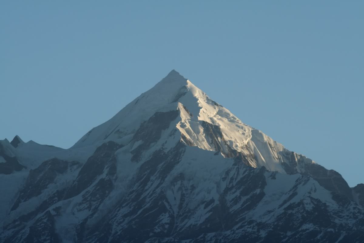
Good morning Munsyari - clear skies today, but it will snow soon
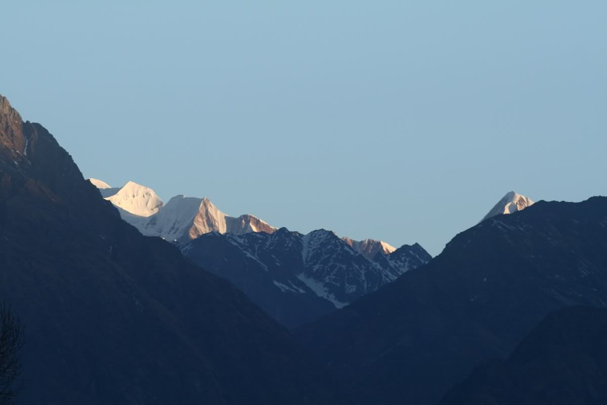
Looking towards the Ralam Valley
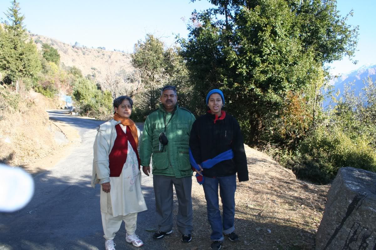
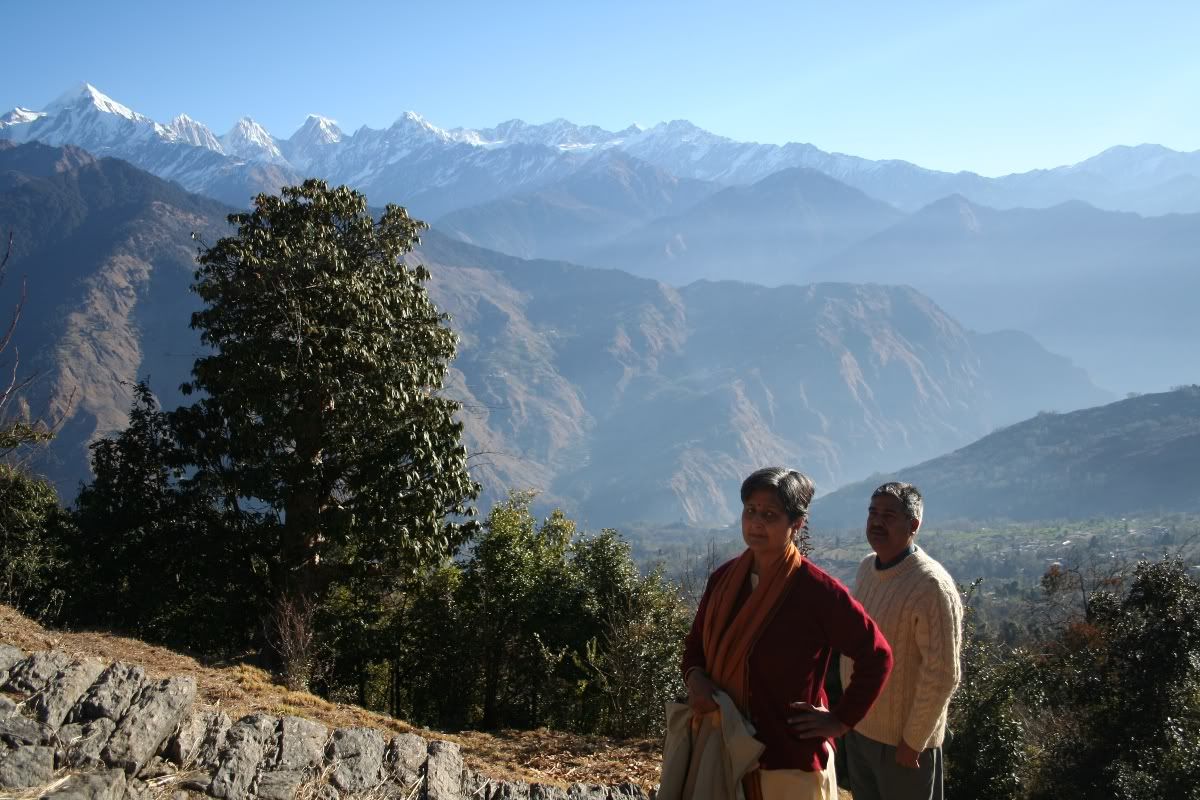
Taking Amma, Babba and Neelakshi towards Masar Kund. this time I was the guide
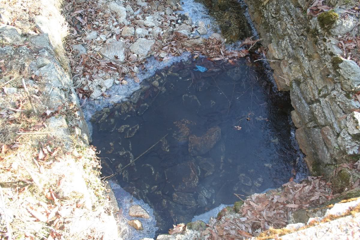
the water had frozen overnight. It was pretty cold in Munsyari.

tiring climb, eh? :-)
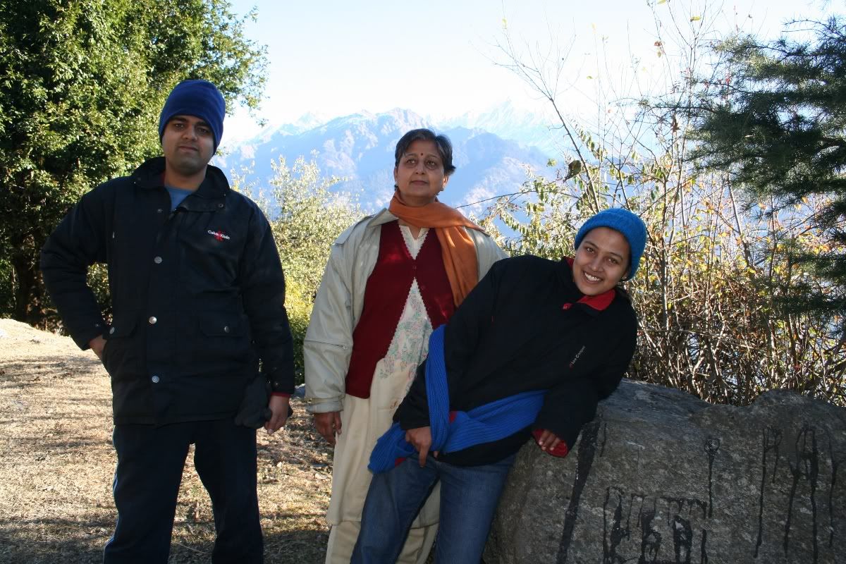
Reached the kund area. Uou won't see such blue skies in the cities.

Amma and Babba were really tired. I made them walk a lot. ha ha ha.
Home -
Kumaon Road Trip -
Munsyari Town Stay - Part 1
1 Comments:
Hi, My name is Anand Singh Haldua live in delhi. my grand mother told me that our fore-fathers came down from Haldwani. I or anyone in our family have no idea about our background. Can you please share something. I shall be grateful. My email id is- anand329@rediffmail.com
Post a Comment
<< Home